
I don’t know about you, but after this spring’s quarantine, I’m really ready to turn the page on spring and move on to summer.
Here on Maui, we couldn’t be more fortunate as state parks begin the slow process of reopening. We can finally start to get back to some sense of normalcy. But it’s important we maintain social distancing despite our sunny outlook.
Hiking on Maui is the ideal activity because you can still get plenty of fresh air and exercise while keeping your distance on the trails.
Here are a few suggestions for how to stay safe and healthy on any hiking trail:
- To avoid crowds, plan your hike early or late in the day.
- Wear a mask, or at least have one around your neck ready to pull up if you suddenly find yourself in a tight spot with other hikers.
- Walk single file (even on wide paths so you don’t further narrow trails) and keep at least 6 feet apart at all times.
- Limit your hiking group to only those with whom you’ve already been in close contact. Now isn’t the time to invite along friends and family members you haven’t seen in a while.
- Don’t stop and congregate along the trails. Keep moving so as not to force other hikers to walk a gauntlet between your group.
- Make noise if you’re trying to pass slower hikers. Let them know you’re coming up behind them and on what side you intend to pass.
- Yield to everyone and know that it’s okay (for now) to carefully step off the trail at a 90-degree angle to wait for other hikers to pass.
- Don’t gather in the parking lots for celebratory beers and storytelling before or after your hike.
Nothing you can’t handle, right?
So, now let’s talk about those excellent hikes on Maui. The island has an abundance of wonderful trails that range from easy family trails to more grueling intermediate and advanced hikes. Maui’s varied terrain and breathtaking views put hiking at the top of just about anyone’s to-do list while on the island. Here are five of the best Maui hiking trails you can take right now.
Polipoli State Park (moderate)
Source: haleakalacrater.com
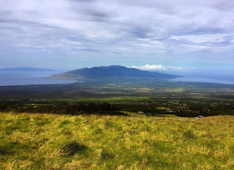
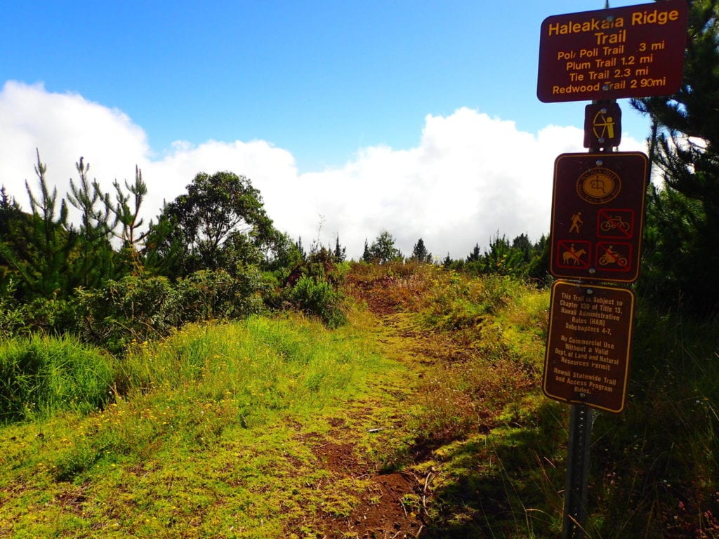
The lush Kula Forest Reserve provides the perfect backdrop for a memorable day hike. Sitting at an elevation of 6,200 feet, the Polipoli Spring State Recreation Area is more like a forest you’d find along the Pacific Northwest than a tropical rainforest. Trails pass through thick patches of cedar, cypress pine and redwood trees. The state park has unparalleled views of Central and West Maui, Kahoʻolawe, Molokaʻi and Lanaʻi when the weather is clear. Hikers can choose from four named trails: Haleakalā Ridge Trail, Plum Trail, Polipoli Trail and Redwood Trail.
Source: alltrails.com
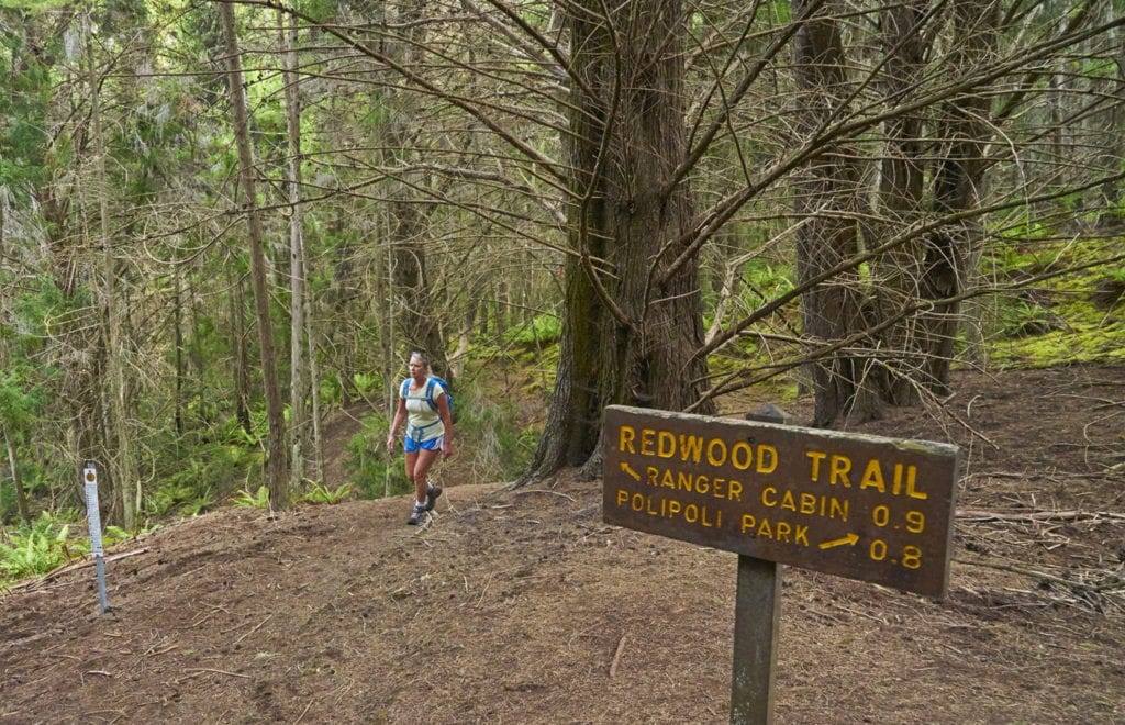
The 1.7-mile Redwood Trail begins at the recreation area and winds through trees down to an old ranger cabin at about 5,300 feet (about a 900-foot descent.) The moderate-rated trail ends at the former Civilian Conservation Corps Camp. There, a three-way junction is the beginning point for both the Boundary Trail and the Plum Trail.
Source: maui-hikes.com
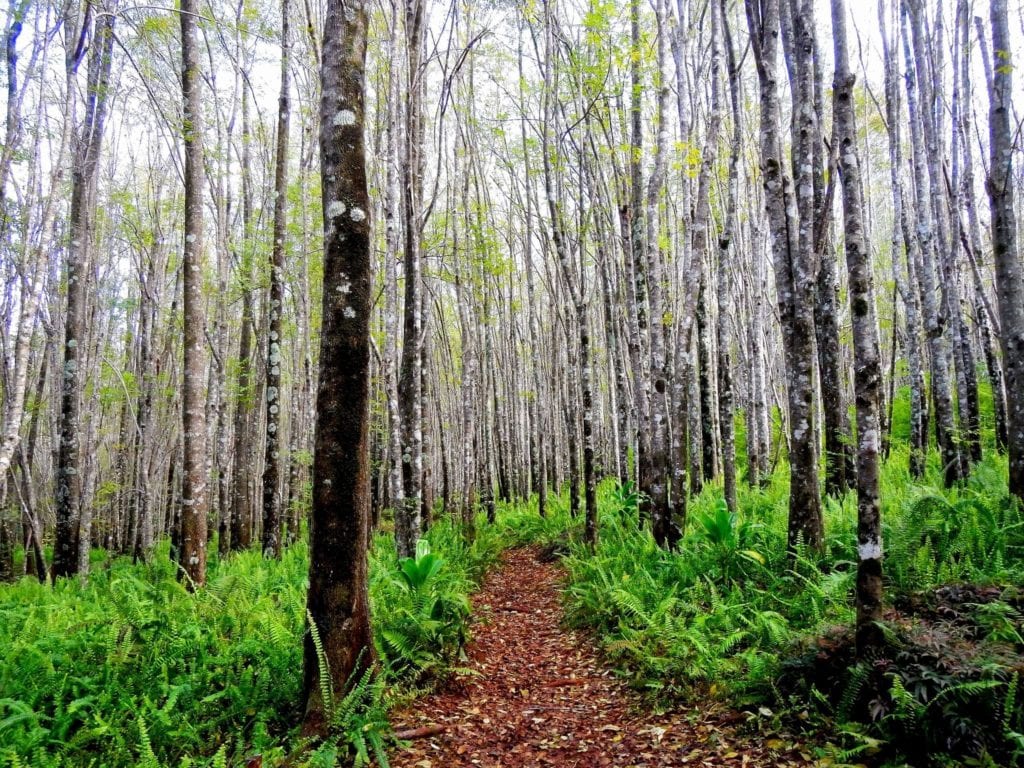
The Plum Trail continues for an additional 1.7 miles through a beautiful planted forest filled with ash, plum and redwood trees until it meets up with the Haleakalā Ridge Trail. At that point, hikers can continue down the crest of the southwest rift of Haleakalā past the trail junction to the forest reserve boundary and enjoy panoramic views that are some of the island’s best.
How to Get There: The Polipoli State Park is just past Pukalani on Highway 37 at the second junction of Highway 377. From there, the park is just to the left, off Waipoli Road. This road becomes the Polipoli Access Road at the first cattle guard. The road climbs the mountain along several switchbacks before entering the park at about 6,400 feet.
Makawao Forest Reserve (moderate)
Source: alltrails.com
The 2,000-acre Makawao Forest Reserve on the northwest slope of Haleakalā serves up the popular Kahakapao Trail Loop, with more than 6 miles of hiking and a nice elevation gain near 1,000 feet. Hiking the loop is a fantastic experience. The upcountry Nā Ala Hele trail twists through a beautiful Hawaiian rainforest at nearly 4,000 feet above sea level. It is well maintained and easy to navigate despite being a more strenuous hike. There are also activity options along the moderate-rated trail.
The real splendor of the journey is the wealth of native plants, trees, and shrubs along the route, including Koa trees, Cook pines, tropical Ash, Hala Pepe, Eucalyptus, Leʻle, Mamaki, Pilo, and Kupu-Kupu. The loop is ideal for an afternoon hike because the canopy provides plenty of shade when temperatures are at their peak. The loop is accessible all year long, open to bikes, and leashed dogs.
How to Get There: The trailhead is just outside of Makawao town off Waiohiwi Road. From Waiohiwi Road, turn right onto Kahakapao Road and take it until it ends. Along the way, you’ll pass a gate that allows access from 7 a.m. to 7 p.m. daily. From there, the road is steep and narrow to the trailhead, but accessible by any vehicle. There are portable toilets at the trailhead, but no other services. A wide dirt road at the parking area will lead you to the beginning of the loop. From the beginning point, the loop ascends to the high point of the trail in both directions.
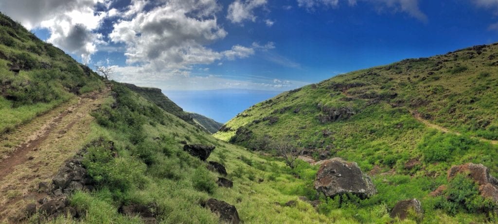
Waihee Ridge (moderate)
Spectacular Waihee Ridge Hiking Trail in the West Maui mountains gives early morning hikers the sensation of being able to reach up and kiss the sky. The 5-mile out-and-back trail in Mauna Kahalawai ascends more than 1,500 feet through a thick forest and up into the clouds. The scenic hike is one of the island’s best but start early if you want a cloud-free view of the Waihee Valley.

The moderate-rated hike begins with a steep, 200-foot incline that will test your grit right from the start. Your efforts are quickly rewarded, however, with views of epic Makamakaole Falls just off to the right. Head left at the trail sign to pass through a pasture and enter the forest. The trail climbs the windward slope of the island, passing through a guava thicket, several planted trees, and wet native scrub forest. The trail is mostly straightforward, well-marked, and has varying sections of inclines and flat terrain.
About a mile into the hike, you’ll be treated to some excellent views of the valley. There are views of Makamakaole Gulch and Waihee Gorge along the route. After a series of switchbacks, you’ll see clear views of the valley at about 2,500 feet. (This is where you want to be before the clouds move in mid-morning.) At the top, hikers are rewarded with panoramic views of Wailuku and central Maui, the Kahakuloa slopes and Mt. Eke.
How to Get There: Take Highway 32 out of Kahului about three miles to Highway 330. Take Highway 330 until it becomes Highway 340 at mile marker 2. Just past mile marker 6, turn left at the Maluhia Boy Scout Camps and travel about one mile to the parking area. There is a sign on a fence that marks the trailhead.
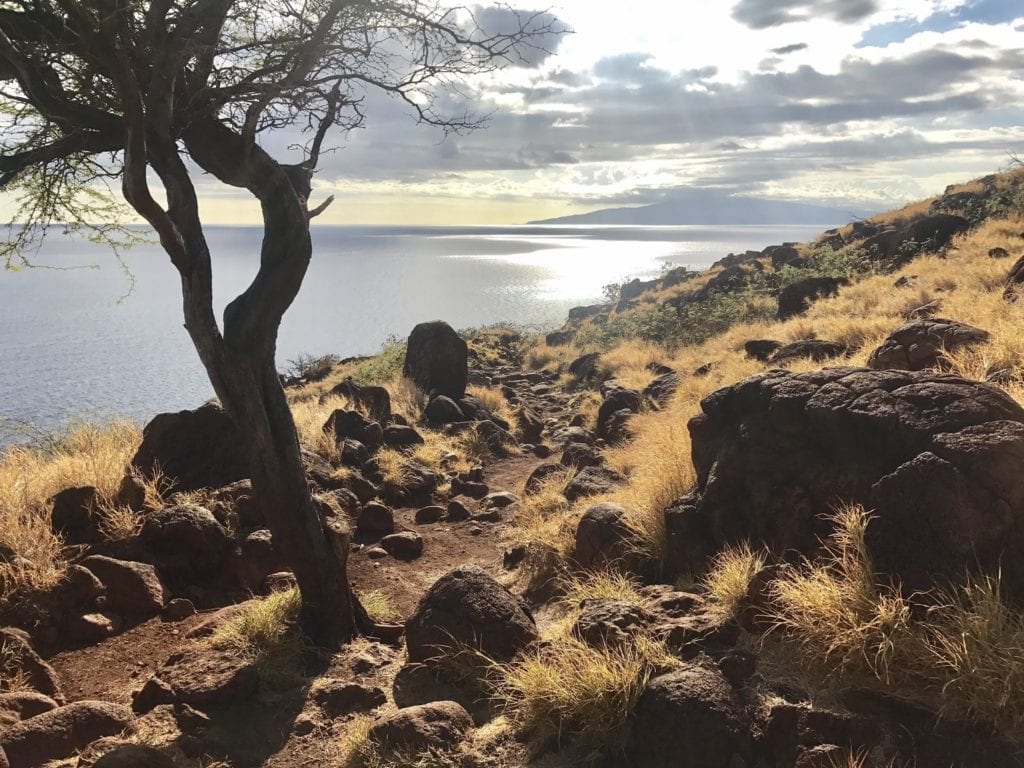
La Perouse Bay (intermediate)
Looking for a dramatic hike on Maui? The lava fields on Maui’s southeast shore at La Perouse Bay are a great choice. The King’s Trail (of King’s Highway) at La Perouse Bay provides hikers with the opportunity to walk next to the island’s youngest lava fields and follow in the footsteps of Hawai’ian King Pi’ilani, who created the footpath in the 16th Century.
The jagged coastline was drastically altered in 1790 when Haleakalā erupted. Today, there is a monument and ruins left by Hawai’ian natives who made their homes on the sharp a’a lava rock. The rocky, jagged terrain of Maui’s southern-most point delivers a stark contrast to the green mountainside of Haleakalā, bright white beaches, beautiful crystalline ocean, and bluebird Hawai’ian sky. The trail follows the shoreline and passes through a grove, several coves, and remains of old Hawai’ian settlements.
The trail has many types of lava features along the way, such as lava arches, lava sea cliffs, and lava-formed tidepools. Look for small creatures living in the tidepools. Walkthrough the lava fields and investigate the many sea estuaries. There are smooth lava sections and rougher lava areas, so be sure to wear sturdy shoes.
How to Get There: Take Route 31 south to Wailea-Alanui Drive, which becomes Makena Road. Continue south on Makena Road until the road narrows. There, drive directly over Maui’s last lava flow to the parking lot at La Perouse Bay. (Be sure to park on the road and not on lava rock as it can cause your tires to go flat!) The King’s Trail walking path begins near the parking lot and extends south.
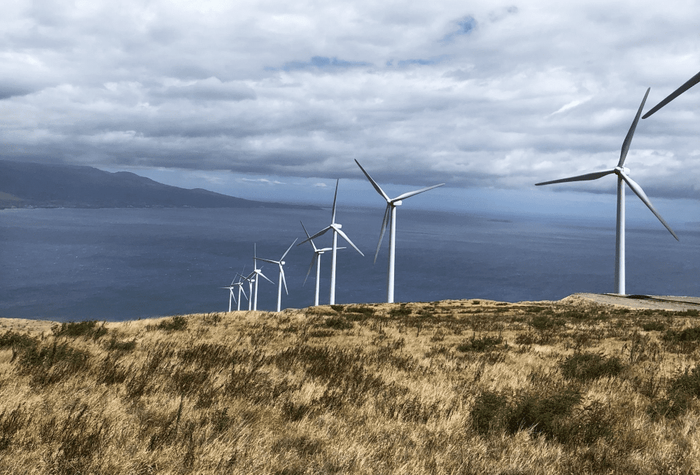
Lahaina Pali Trail (difficult)
The Lahaina Pali Trail is a five-mile out-and-back trail with a rich history. The trail was originally built by hand more than 200 years ago for horseback and foot travel between Maalaea and Ukumehame. This fun hike takes you through the Kaheawa wind farm and its more than 30 wind turbines.
Source: alltrails.com
Tallgrass lines the route. The trail climbs more than two miles to Kealaloloa Ridge and backs down to the highway. The entire trek from one end to the other is about 10 miles, so leave a car at the other end if you plan to go one way. Many hikers choose to go only halfway, then backtrack to their car. Sixteen numbered markers along the trail explain historical features, so be sure to get the “Tales from the Trail” guide before you go.
Source: alltrails.com
The Lahaina side (west side) is the easiest path to take. In the winter months, the Lahaina side is an ideal spot for whale watching. The Kihei side (east side) has panoramic views of Haleakalā, the Central Valley and the coast around Kihei and Maalaea.
The trail begins with an uphill climb to Kealaloloa Ridge. The trail has only a few trees and can be hot, so start early (daybreak is best). At the crest of the ridge, the wind farm begins. From the service road, you’ll be directly below the 160-foot-tall wind turbines with excellent views of Haleakalā, Ma’alaea Bay, Molokini and Kaho’olawe. On a clear day, you can even see the big island of Hawaii.
Source: alltrails.com
This difficult-rated trail is well-marked but very steep in some sections, so it can be slow-going at points. Wear sturdy shoes and bring plenty of drinking water. The area has lots of dry brush, so fires can flare up quickly. Please, no smoking, campfires or open flames of any kind.
How to Get There: To start at the Ma’alaea side, park on the side of Honoapiilani Highway or the parking lot at the trailhead. To take the Ukumehame side, park at Manawaipueo Gulch about a quarter-mile north of the Pali tunnel.
Hiking on Maui is a perfect way to experience the wonders of this island paradise while still maintaining appropriate social distancing.
Unwind at the end of a day of hiking in the comfort of a beautiful Ali’i Resorts beachfront vacation rental villa, or condo–your Hawaiian home-away-from-home. Relax in casual island style gazing out at stunning mountain vistas or ocean panoramas. Enjoy meals on your own time in your own place with fully equipped kitchens.
Start planning your Maui vacation today. Visit Ali’i Resorts.